The Carretera Austral: A Patagonian adventure of a lifetime
- Jordan Gottlieb

- Dec 14, 2020
- 9 min read
Updated: Sep 17, 2021

Glacial waterfalls, tropical plants, dolphins, marble caves: Patagonia’s remote Carretera Austral is an explorer’s paradise.
National Geographic describes it best. The Chilean lakes district of Patagonia is a truly a rugged region—isolated, wild, and ecologically diverse. Where else could you stand next to human-size rhubarb leaves, watching dolphins play in a fjord while impressive waterfalls cascade from the glaciers behind you?
To see it all would take years. But on a road trip down Chile’s Route 7—also called the Carretera Austral—you can pack the Patagonian adventures of a lifetime into a two-week journey.
Our trip was truly action packed, awe inspiring, and an unforgettable experience. We ran into many fellow travelers but it felt the opposite of "touristy".
This region is only accessible by one dirt road, with ferries to connect across the fjords and a couple small airports. Chile is investing heavily into the region to drive tourism but it's definitely still a work in progress. There were a few paved strips of the 776 mile stretch of road that we traveled. There were also a couple high-end resorts. For the most part though, it's a narrow dirt road and mom-n-pops. It felt like an authentic experience with locals and travelers who were brave enough to brace the conditions (more on weather later) and get off-the-beaten-path.
Itinerary
12/13 Leave for Santiago ✈️
12/14 Land in Santiago -> Land Puerto Montt - Pickup car -> Hornopirén ✈️🚗⛴
12/15 Hornopirén -> Pumalín National Park 🚗⛴
12/16 Pumalin NP -> Queulat National Park (Puyuhuapi) 🚗
12/17 Puyuhuapi -> Coyhaique (drop off car) 🚗
12/18 Coyhaique -> Cerro Castillo Nature Reserve (Cerro Castillo Trek) 🚌🥾
12/19 Villa Cerro Castillo -> Puerto Río Tranquilo 🚕👍
12/19 Puerto Río Tranquilo -> Cochrane 🚕👍
12/20 Cochrane -> Villa O'higgins 🚌
12/22 -12/23 Villa O'Higgins -> El Chalten Border Crossing Trek 🥾
12/24 El Chalten Los Glaciares National Park 🚌
12/25 El Chalten -> Santiago ✈️
Link to Driving Route
Hornopirén
As with most the towns along the Carretera, Hornopirén was tiny but also charming. We didn't spend much time here but did have an absolute gem of a host at the b&b we stayed at.
If we had more time on the way to Hornopirén, I would have added in a stop at Cochamó Valley, the Yosemite of Chile. Looked to be some awesome backpacking and rock-climbing. For more details see here.
Transportation & Housing
Turismo Lahuan We had some amazingly warm and hospitable hosts on our journey but Betty took the cake. She waited up for us as we didn't get in until late, stoking the fireplace so we walked into a perfectly warm home. She packed us breakfast + lunch and helped us coordinate buying tickets for the ferry the next day. Absolute sweetheart and the place was also great!
No need to book Ferry on the way from Puerto Montt in advance, runs every 15min
Douglas Tompkins, founder of Northface, and his wife Kristine purchased over 700,000 acres of untouched rainforest and built it into what is now Pumalín National Park. It's pristine, trails and campsites are well kept and unbelievably fun to explore! This is an absolute must stop along the Carretera.
Rating: 🥾🥾🥾🥾
Hike Length: 1 mile round trip
Elevation Gain: none
Difficulty: Very easy
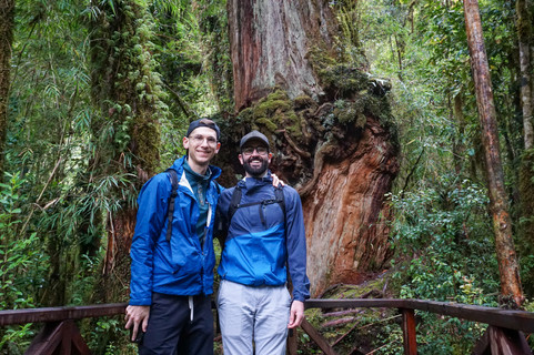
Alerce trail is a quick and easy trail through a forest of giant Alerce trees, one of which has a very interesting knot.
Rating: 🥾🥾🥾🥾
Hike Length: 2.8 miles round trip
Elevation Gain: 920 feet
Difficulty: Easy
Two waterfalls for the price of one! You also kind of felt like you're playing a real life version of shoots and ladders.
Rating: 🥾🥾🥾🥾🥾
Hike Length: 3.4 miles round trip
Elevation Gain: 2000 feet
Difficulty: Moderate
This was one of my favorite hikes of the trip. Beautiful climb up the mountain, started out with an apocalyptic looking sky but the clouds parted at the summit to a smoking red volcano overlooking a turquoise glacial lake.

Transportation & Camping
Ferry hornopiren to caleta gonalo runs 9:30 am daily, can buy tickets day of or in advance (recommended)
El Volcan Campsite - There are plenty of campsites, I'm sure they're all awesome. We chose Volcan as it was supposed to be one of the best. It's about 4.5 miles north of the volcano trail. One of the nicest campsites I've ever been to. Amazing views of wild meadows and mountains as its backdrop. Sites are pretty spread out and private. It had a lifted manicured lawn to put your tent on, which is really nice for the erratic Patagonia weather!
Santa Barbara Beach - Great pitstop for lunch with a view, and some dolphins! Apparently people camp here too. Located 8.5 miles south of the volcano trail. We actually jumped the gun and I think went on someone's private property by accident instead of the actual beach... whoops 🤷♂️
More details on the park and campsites here.
Queulat National Park (Puyuhuapi)
Right outside the town of Puyuhuapi, Queulat NP has one of the most iconic hikes of the trip - the Hanging Glacier (Ventisquero Colgante).
Rating: 🥾🥾🥾🥾🥾
Hike Length: 4 miles round trip
Elevation Gain: A descent climb
Difficulty: Easy/Moderate
It was a wet, muddy walk through an enchanted forest to the get to the hanging glacier lookout. We saw about 15 people coming down that all said "you not going to see anything" because it was completely fogged over. The visibility gods were on our side. The sky parted just as we got to the observation deck at the top of the hike.

Lodging
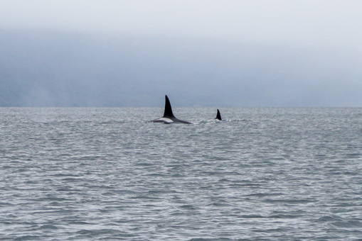
Puyuhuapi Lodge & Spa - After a few days on the trail, could not have dreamed of a better way to treat-yo-self than Puyuhuapi Lodge & Spa. The resort is right on the fjord with several natural hot springs and five star service, this place was special. As if that wasn't enough, apparently it's common to see Orcas in the Fjord!🐳
Note, it's only accessible by boat, so make sure to get to the pickup spot by last boat time or you will have to pay for private shuttle to hotel.
Coyhaique
We happened to catch one of the best rainbows of the trip through Villa Maniguales on our way to Coyhaique. There was a nature reserve right outside the city but got in late and didn't have time to check it out. This is where we dropped the car and grabbed a bus to Cerro the next day.
Lodging
Coyhaique Patagon Backpackers - Hostile was clean and the staff was super helpful.
Cerro Castillo Nature Reserve (Cerro Castillo Trek)
Rating: 🥾🥾🥾🥾🥾
Hike Length: 15 miles round trip
Elevation Gain: 1,700 ft
Difficulty: Moderate
+ 4 mile 1,500 ft day hike up to the pass, since the loop we wanted to do was closed
Due to the weather, this was not exactly the route we planed but still an awesome trek! Started out pretty flat along the river then quickly when up through the forest and into the mountains. The campsite we went to was right on the trail went so we went slightly down and found some privacy.
Tips
Bus leaves from Coyhaique at 9-9:30am daily (can buy day of)
We intended on doing a one night loop but the trail we wanted to take up was closed (red) due to weather (the pass was too dangerous in the conditions). So we ended up doing an out and back instead (green) with a short day hike (dotted green) up just about to the pass lookout view.
If you want to do the full version of the through hike, ask the busto stop at Las Horquetas (where the through hike starts, 30 Km before Villa Cerro)
Bring cash
Watch out for the cows!
More on Cerro Trek / other variations here

Map
Food
La Cocina de Sole - Sandwiches pre and post hike. wow.
Puerto Río Tranquilo
Quick aside on hitchhiking: It's part of the culture along the Carretera. Locals do it to commute, travels do it as access to the area is remote and limited. You can get away with taking buses or paying for a private shuttle but this was definitely an enriching experience, the ups and the downs. Had we more time would have likely traveled more days this way.
We attempted to hitchhike from Cerro all the way to Lodge Bordebaker but ended up staying the night in Puerto Rio Tranquilo. Saw a lot of people going on to kayak out to the marble caves, which looked awesome. We opted to keep on moving as we were already behind schedule.
Cochrane

Drive by of La Confluencia at Patagonia National Park, wish we had more time to go hike down to the beach at the confluence of the Baker and Chacabuco Rivers. We stayed at Hotel Ultimo Paraiso, with yet another amazing host and great accommodations! We didn't end up making it to the park but even the short walk around the town was beautiful.
We booked a van in town to take us down to Villa O'Higgins.

Caleta Tortel
Very cool fishing town built into the side of the mountain. Definitely worth a stop to check out on the way from Cochrane to Villa O'Higgins
Villa O'Higgins
Second act of treat-yo-self, enter Lodge Robinson Crusoe Deep Patagonia stage left.
The rooms were clean and modern, lodge was cozy and the wood-fired hot tub overlooking the mountains was an experience in and of itself. We ended up spending an extra night here because the downpour and 20+ mph gusts prevented the boat from running across the lake (see what it looked like on a good day below). Pretty awful place to be "stuck" for another night. I could have stayed for weeks!
Sender Rio Mosco - Mirador Del Valle
Rating: 🥾🥾🥾
Hike Length: Short
Elevation Gain: not too much
Difficulty: Easy
There were actually a bunch of good looking hikes to glacial lakes right out of the Villa O'higgins. I opted for a shorter hike in the rain and more time in the cozy lobby and hot tub. Beware, the forrest getting up to the look out was real spooky.

Boarder Crossing Trek:
Lago O'Higgins, Chile -> El Chaltén, Argentina

This trek was my favorite of the trip.
It had all the right ingredients of a Patagonia trek. Glacial lakes, river fording, chaotic weather, adversity/challenge, iconic view of Mt. Fitz Roy and a boarder crossing in the middle wilderness! On second thought, this might be one of my favorite treks, period.
Step one: Get across Lago O'Higgins. You can book this boat in town (day before). If we had more time would have opted for the more scenic route where you can see the O'higgins glacier!
No wonder they wouldn't run the boat when it was a torrential down poor. There was a French family sitting behind us that was biking the entire Carretera, the two little kids were loving the boat ride!
The weather cleared up and it was a stunning view once we finally arrived.

Step Two: Passport control in the middle of the wilderness, only accessible via boat from Chile or horseback from Argentina.
Step Three: Trek 13.7miles to Lago Del Desierto where you can catch a ferry across the lake. This part of the trek was actually relatively easy. We also caught the clearest view of Fitz Roy of the trip! The trail on the Argentinian side is not as well kept and got a little tough to follow as you get closer to the lake but not too bad.

Step Four: Audible and trek another 7.5 miles along side the lake when you find out the ferry isn't coming because the road had flooded to Punta Sur the day before so no one showed up on the other side of the lake.
This part was fun, at least in hindsight. The trail was mostly right along side the lake and had pretty much flooded from the rain. It was a lot of bushwhacking to higher ground and fording rivers. The glaciers and ice fields created their own weather, one minute it would be sunny the next the apocalypse.
A couple of French cyclists that had come from Punta Sur said they did it in a few hours... no chance. We got 90% away across the lake then grabbed a "campsite" right down by the water, ate and passed out. We finished the last mile to Punta Sur the next day.
For more details on how to do the trek see here. It would have been nice to break this up into two nights, had we known the ferry might not run. Also, there were some cool looking side trials to glaciers that you could do.

Rating: 🥾🥾🥾🥾🥾
Hike Length: 21.2 miles
Elevation Gain: 3,100+
Difficulty: Hard
El Chaltén Los Glaciares National Park
Laguna Capri
Rating: 🥾🥾🥾🥾🥾
Hike Length: 7 miles round trip
Elevation Gain: ~1,000 ft
Difficulty: Medium
El Chaltén was easily my favorite town of the trip.
Nestled right into the mountains you literally walk off of the main street and into Los Glasciare National Park - home to Mt. Fitz Roy. The town itself is packed with breweries, cafes, bakeries, restaurants, outfitters and adventurers from all over the world.
We only had a day so didn't get to cover as much as we would have liked to but there is a great resource for other day-hikes here. I will absolutely be going back here for Laguna Torre and the Huemul Circuit trek.
Transportation, Lodging and Food
infinito Sur - Solid hostile with a great view.
Restaurante Ahonikenk Chalten Fonda Patagonia - There is a ton of good food in town, we ate one of the best lunches of the trip here!
Can book bus to Calafate airport day of
Weather & Packing List
Oh man, the weather is sporadic to say the least. It can be sunny and beautiful one minute and hailing with 20 mph winds the next. The glaciers and ice fields create their own weather patterns. In short, bring layers and pretty much all of the rain gear items.
It's also good to bring cash, USD and Chilean Pesos. ATMs can be few and far in between.


Comments