Capitol Reef: The most overlooked of the Mighty 5
- rjayakar1
- Dec 6, 2020
- 4 min read
Updated: Dec 24, 2020
The drive from Escalante to Capitol Reef (approx 1.5h) is extremely beautiful and mountainous, but be careful with the icy roads in winter. Some of the most amazing scenery and views on that segment of the 12. Capitol Reef, or more specifically, the town of Torrey, is definitely more travelled than Escalante, but by far the most remote of the Mighty 5 (Zion, Bryce, Arches, Canyonlands, Capitol Reef). It definitely has a more off-the-grid and rugged vibe than the other 4, which I really liked. Note that an AWD high clearance vehicle is recommended, since some of roads in Capitol Reef are dirt/rocky (although less so than Hole in the Rock Road in Escalante)

Where to stay: There are a handful of hotels that all seem similar- we stayed at the Broken Spur which we really enjoyed (great breakfast, great sunset view, comfortable bed). Pool/hot tub open during summer but sadly closed in winter season. You can also stay in yurts but we didn't since they're freezing in winter.

Where to eat: Limited options (especially in winter), but good food. Slackers Pizza and deli had DELICIOUS pizza.
Hikes
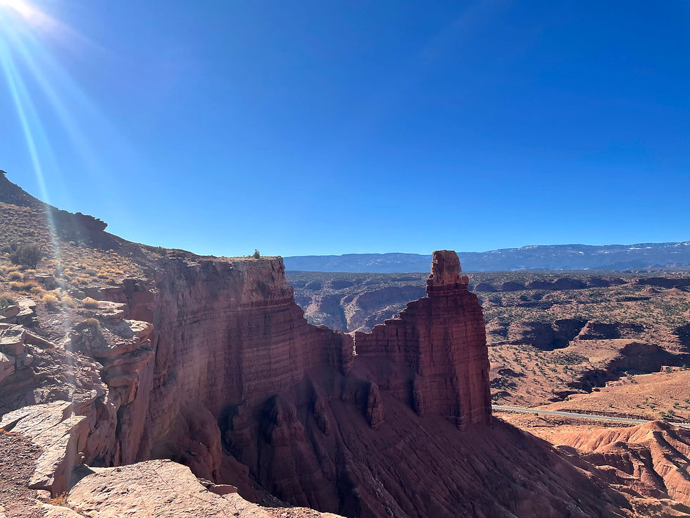
Chimney Rock Trail
Difficulty: Moderate
Distance: 3.3 miles
Elevation gain: 872ft
Duration: Approx 1hr
Great first hike to do in Capitol Reef. Easy, quick hike that gives you good views. Recommend going counter-clockwise to get the uphill out of the way first.
Cassidy Arch Trail
There are multiple ways to get to Cassidy Arch. You can start the hike from Cohab Canyon trailhead and take Frying Pan trail (longer route), or do a shorter route via Cassidy Arch trail (this was our route). There are so many hikes in Capitol Reef, so I recommend doing the shorter Cassidy Arch trail. Alternatively, if you have two cars, you can park one at each end and make the Cohab canyon to frying pain to cassidy arch trail a one-way hike to maximize new views!
Distance: 3.6miles
Elevation gain: 864ft
Duration: approx 1hr
Another great, easy hike with phenomenal views and cool arch at the end. The arch photo below doesn't do it justice but you can google photos if you want real photographer photos. We combined this hike with chimney rock (above) and lower calf creek falls (in escalante post, on the way from escalante) into the same day. Tough day but totally doable!


Navajo Knobs trail
Difficulty: Hard
Distance: 9.42miles
Elevation gain: 2,650ft
Duration: Approx 4.5hr
This was by far our favorite hike in Capitol Reef! If you have time for it, don't miss it! It starts right off the highway by the trailhead of Hickman Bridge trail, but you take the turnoff to Rim overlook trail and then continue to Navajo Knobs trail to the end. Initially, we were planning to do the Hickman Bridge trail (short 1.8mi easy hike) in addition to get to the bridge, but I would recommend skipping this since you get a good view of the bridge from the Rim overlook trail, and it is not nearly as impressive as Cassidy Arch. This trail goes along the rim with amazing views of all of Capitol Reef throughout. Note it is a tough hike and in the sun the whole time, so make sure to bring plenty of water especially in the summer. Most people turn around at the rim overlook point (4 miles total), but I highly recommend extending all the way to the end to Navajo Knobs. We didn't see a single person after rim overlook trail ended. Even though you think the views may be similar beyond, you get much better views and can get a 360 view at the top if you climb the Navajo Knob rock (very doable). This hike is relatively well marked, but at some points you need to follow the cairns on the slabs of rock (just stick near the rim and you can't really go wrong).


This is the peak, but you can actually climb the rock and get an even more spectacular view

The pinnacle!

Mountain Sheep along the way!
Cohab Canyon Trail
One way distance: 1.84mi
One way elevation gain (starting near visitor center toward hickman bridge): 365ft
Duration: 40min
We did this after Navajo Knobs. It pairs nicely with it because one entrance to the trail is right across the bridge/street from the start of Hickman bridge/Navajo Knobs trail. We were tired for this one after Navajo Knobs, so one of us actually started from Hickman Bridge side and the other one drove to visitor center starting point and did it in reverse to make it a one way hike instead of out and back. Note that there is less elevation gain if you start from visitor center side like I did (trust me, you'll want that after Navajo Knobs). Beautiful, very easy hike after the initial uphill with cool canyon formations throughout. However, if time is an issue, this is the first one I'd skip out of all the hikes mentioned above.
Another lookout point:
Panorama point and Gooseneck point- you may see it as a 2.5mile hike on alltrails, but it's not actually a hike. You can drive almost completely to the end, so its a very short walk with good views of the sulphur river below. It's a great sunset spot.
Trip dates: Dec 3-4, 2020


Love the time lapse, I think that was the best segment of route 12. I was wishing we had planned a stop as we were driving through but clearly I overlooked Capitol Reef when researching for my trip. If only you'd gone first.
Navajo Knobs trail sounds awesome, will need to get back down there!